One Country. One Trail.
It is an experience not to be missed: discover the historical highlights of the Principal-ity of Liechtenstein on foot on the Liechtenstein Trail. Where else can you walk an en-tire country in just a few days and learn all about its rich, 300-year history at the same time? Awaiting the explorer are 75 kilometres full of exciting stories, sights, majestic views, idyllic spots to have a rest, and much more.
‘With our experiences of the past, we are setting out on the path to the future’: this is the cen-tral idea which sits at the heart of the celebration in 2019. The central idea reflects the fact that the celebrations will not only focus on the history of the Principality. The anniversary will also be used as an opportunity to critically explore modern Liechtenstein, as well as to illumi-nate possible paths for the future of our small country. The central idea is symbolised in the ‘Liechtenstein Trail’, which connects all of Liechtenstein’s municipalities, and extends an invitation to the whole country, as well as to guests from abroad, to head out on an exciting journey through Liechtenstein. Along this trail, you can not only discover and celebrate the history of the country but also experience the Principality of YESTERDAY, TODAY and TOMORROW.
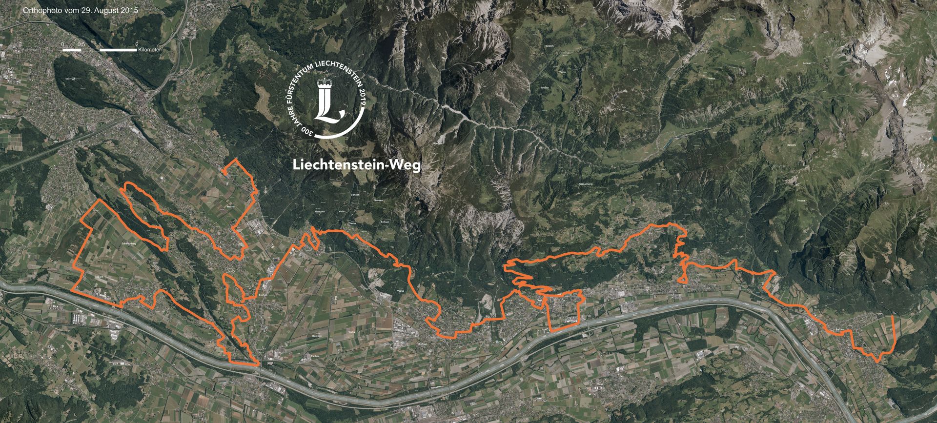
135 specially-selected historical sites and events, so-called Points of Interest (POIs), are all connected through the ‘Liechtenstein Trail’, a route which is around 75 kilometres long. His-torical events which have no geographical connection are placed between the location-specific POIs. The trail follows the existing network of paths and trails through all 11 munici-palities, either from south to north or north to south. It is possible to begin the trail from every municipality. The entire route can be completed in several stages.
No need to worry if you don’t have the app, as the route can also be hiked without the ‘LIstory’ app, thanks to the physical signage along the trail.
Information about the Route
- Launch of the Liechtenstein Trail on 26 May 2019
- The trail goes through all 11 municipalities of Liechtenstein
- The route is 75 kilometres long
- Ascents/descents of 2,000 m/2,000 m
- Min./max. altitude of 429 m/1,103 m
- Overall walking time of 21 hours
- The trail can go from south to north or north to south
- The route exclusively consists of the existing network of paths and trails
- It is possible to begin the trail from every municipality
- Parts of the route are also accessible for people with limited mobility
Download Route
Route layout, Liechtenstein Trail (2.5 mb)
"LIstory" App
Discover the history of Liechtenstein in a new way from 26 May 2019 with the free "LIstory" app.
